Regions and available data
We’ve aggregated hundreds of geospatial datasets for regions across Canada including the Pacific, Prairies, Ontario, Quebec, and Atlantic. Explore the interactive map below to see the cities with available data within each of the 5 regions.


Simplify, shorten, and enrich your policy research and planning process
Visualize policy and data layers in context through our map interface and run reports that capture all the policies affecting a parcel, as well as nearby parks, transit, and development applications.
Ratio.City provides comprehensive data, so you can find everything you need in one place.
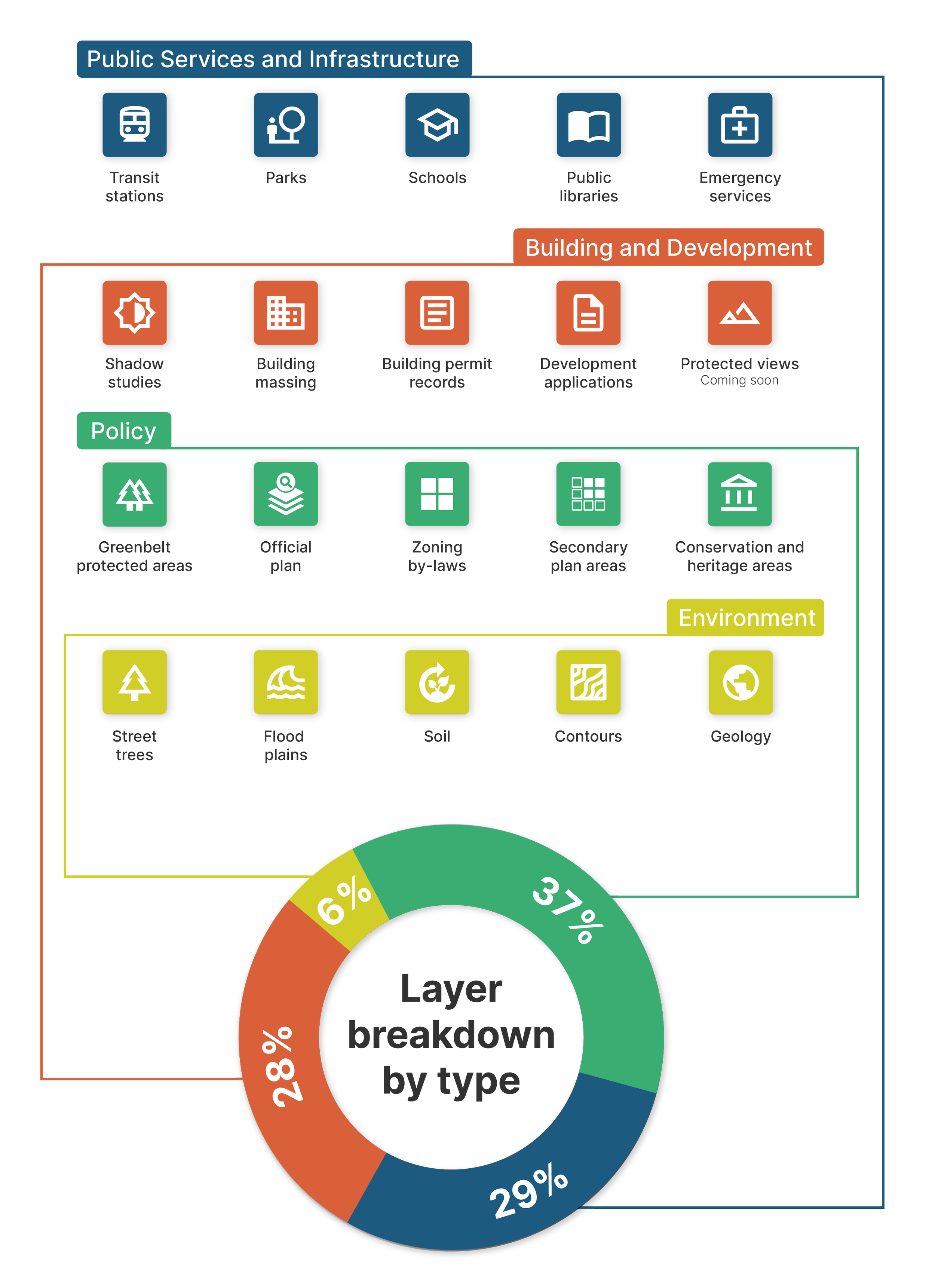
Our ever-growing data catalogue includes the following layers and more:

Sign up for our free trial.
Our free trial gives you a sneak peak into our Explore and Locate tools. Create an account to get started!
See it in action
If you’d like to learn more about our platform, contact our team for a demo today.